Picture credits
The maps are the Library of Congress’s, the photographs their makers’, each shown under the rights its record states. Every one links to its original.
Maps
Sanborn fire-insurance maps of Tyler, Library of Congress
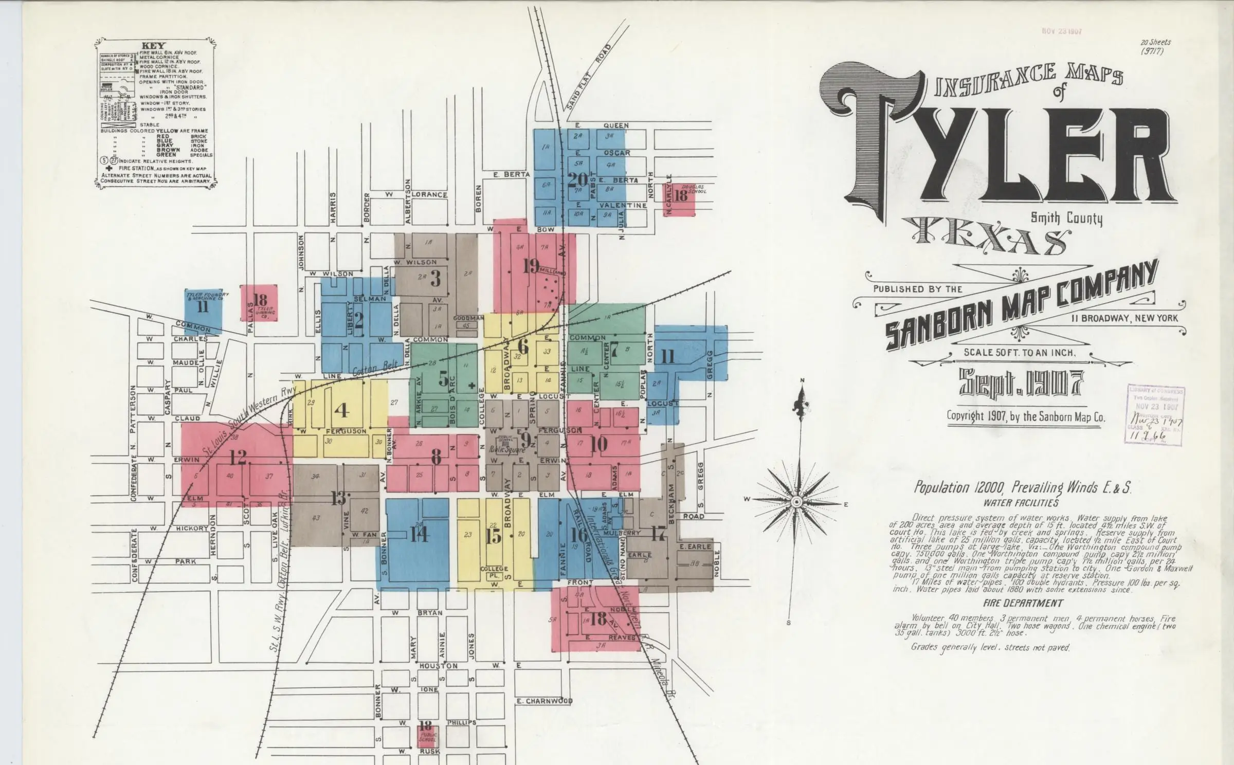
Sanborn Fire Insurance Map from Tyler, Smith County, Texas, 1907 (20 sheet images) (opens in a new tab)
- Date
- September 1907
- Made by
- Sanborn Map Company
- Held by
- Library of Congress, Geography and Map Division
- Rights
- Public domain in the United States: published before 1931
- Credit line
- Sanborn Map Company, Tyler, Smith County, Texas, 1907. Library of Congress, Geography and Map Division, Sanborn Maps Collection.
- Rights statement, word for word
The content of the Library of Congress online Sanborn Maps Collection is in the public domain and is free to use and reuse. Credit Line: Library of Congress, Geography and Map Division, Sanborn Maps Collection. More about Copyright and other Restrictions. For guidance about compiling full citations consult Citing Primary Sources.
- Shown here
- Sheet 1, September 1907: the key map, the title and the notes. Detail of sheet 1 (the index below it is left out). On BR-3 In the maps’ own words.
- The last line of the notes, as written. Detail of sheet 1, at full resolution. On BR-3 In the maps’ own words.
- Original
- loc.gov (opens in a new tab)
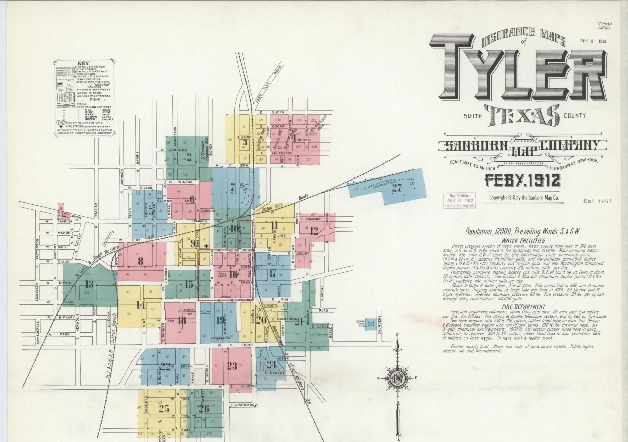
Sanborn Fire Insurance Map from Tyler, Smith County, Texas, 1912 (27 sheet images) (opens in a new tab)
- Date
- February 1912
- Made by
- Sanborn Map Company
- Held by
- Library of Congress, Geography and Map Division
- Rights
- Public domain in the United States: published before 1931
- Credit line
- Sanborn Map Company, Tyler, Smith County, Texas, 1912. Library of Congress, Geography and Map Division, Sanborn Maps Collection.
- Rights statement, word for word
The content of the Library of Congress online Sanborn Maps Collection is in the public domain and is free to use and reuse. Credit Line: Library of Congress, Geography and Map Division, Sanborn Maps Collection. More about Copyright and other Restrictions. For guidance about compiling full citations consult Citing Primary Sources.
- Shown here
- Sheet 1, February 1912: the key map, the title and the notes. Detail of sheet 1 (the index below it is left out). On BR-3 In the maps’ own words.
- The line, as written. Detail of sheet 1, at full resolution. On BR-3 In the maps’ own words.
- Original
- loc.gov (opens in a new tab)
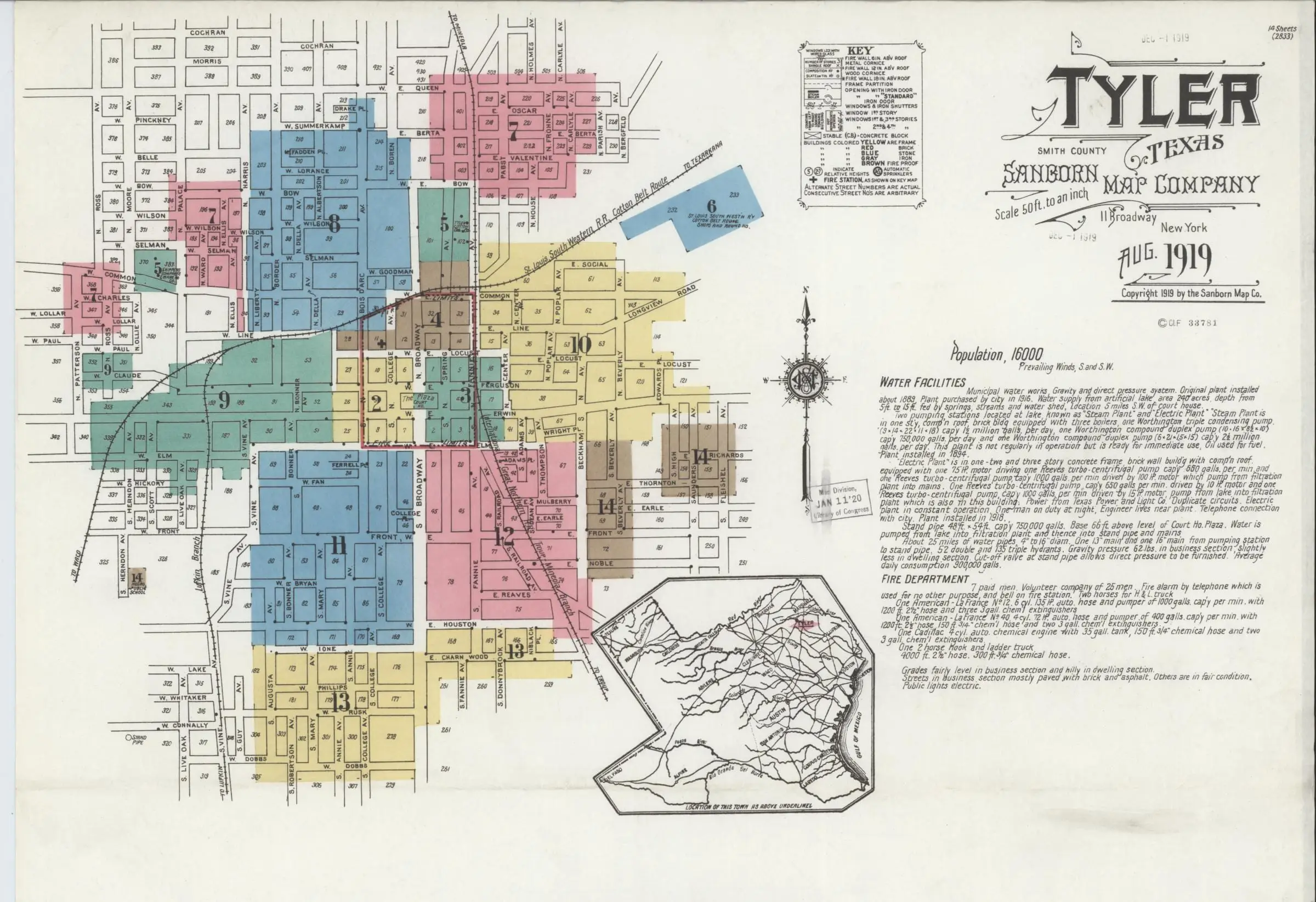
Sanborn Fire Insurance Map from Tyler, Smith County, Texas, 1919 (14 sheet images) (opens in a new tab)
- Date
- August 1919
- Made by
- Sanborn Map Company
- Held by
- Library of Congress, Geography and Map Division
- Rights
- Public domain in the United States: published before 1931
- Credit line
- Sanborn Map Company, Tyler, Smith County, Texas, 1919. Library of Congress, Geography and Map Division, Sanborn Maps Collection.
- Rights statement, word for word
The content of the Library of Congress online Sanborn Maps Collection is in the public domain and is free to use and reuse. Credit Line: Library of Congress, Geography and Map Division, Sanborn Maps Collection. More about Copyright and other Restrictions. For guidance about compiling full citations consult Citing Primary Sources.
- Shown here
- Sheet 1, August 1919: the key map, the title and the notes. Detail of sheet 1 (the index below it is left out). On BR-3 In the maps’ own words.
- The line, as written. Detail of sheet 1, at full resolution. On BR-3 In the maps’ own words.
- Original
- loc.gov (opens in a new tab)
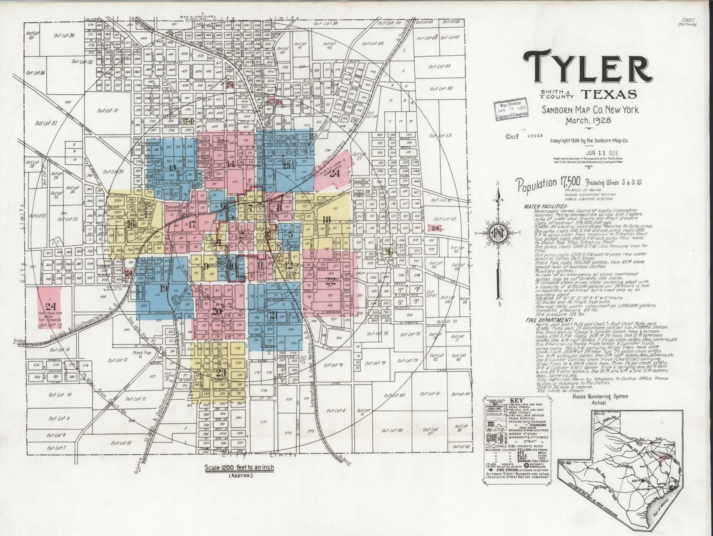
Sanborn Fire Insurance Map from Tyler, Smith County, Texas, 1928 (24 sheet images) (opens in a new tab)
- Date
- March 1928
- Made by
- Sanborn Map Company
- Held by
- Library of Congress, Geography and Map Division
- Rights
- Public domain in the United States: published before 1931
- Credit line
- Sanborn Map Company, Tyler, Smith County, Texas, 1928. Library of Congress, Geography and Map Division, Sanborn Maps Collection.
- Rights statement, word for word
The content of the Library of Congress online Sanborn Maps Collection is in the public domain and is free to use and reuse. Credit Line: Library of Congress, Geography and Map Division, Sanborn Maps Collection. More about Copyright and other Restrictions. For guidance about compiling full citations consult Citing Primary Sources.
- Shown here
- Sheet 1, March 1928: a key map of the whole town. Detail of sheet 1 (the index below it is left out). On BR-3 In the maps’ own words.
- The line, as lettered. Detail of sheet 1, at full resolution. On BR-3 In the maps’ own words.
- Original
- loc.gov (opens in a new tab)
Sanborn Fire Insurance Map from Tyler, Smith County, Texas, 1938 (59 sheet images) (opens in a new tab)
- Date
- 1938
- Made by
- Sanborn Map Company
- Held by
- Library of Congress, Geography and Map Division
- Rights
- Public domain: the Library of Congress states its online Sanborn collection is free to use and reuse
- Credit line
- Sanborn Map Company, Tyler, Smith County, Texas, 1938. Library of Congress, Geography and Map Division, Sanborn Maps Collection.
- Rights statement, word for word
The content of the Library of Congress online Sanborn Maps Collection is in the public domain and is free to use and reuse. Credit Line: Library of Congress, Geography and Map Division, Sanborn Maps Collection. More about Copyright and other Restrictions. For guidance about compiling full citations consult Citing Primary Sources.
- Shown here
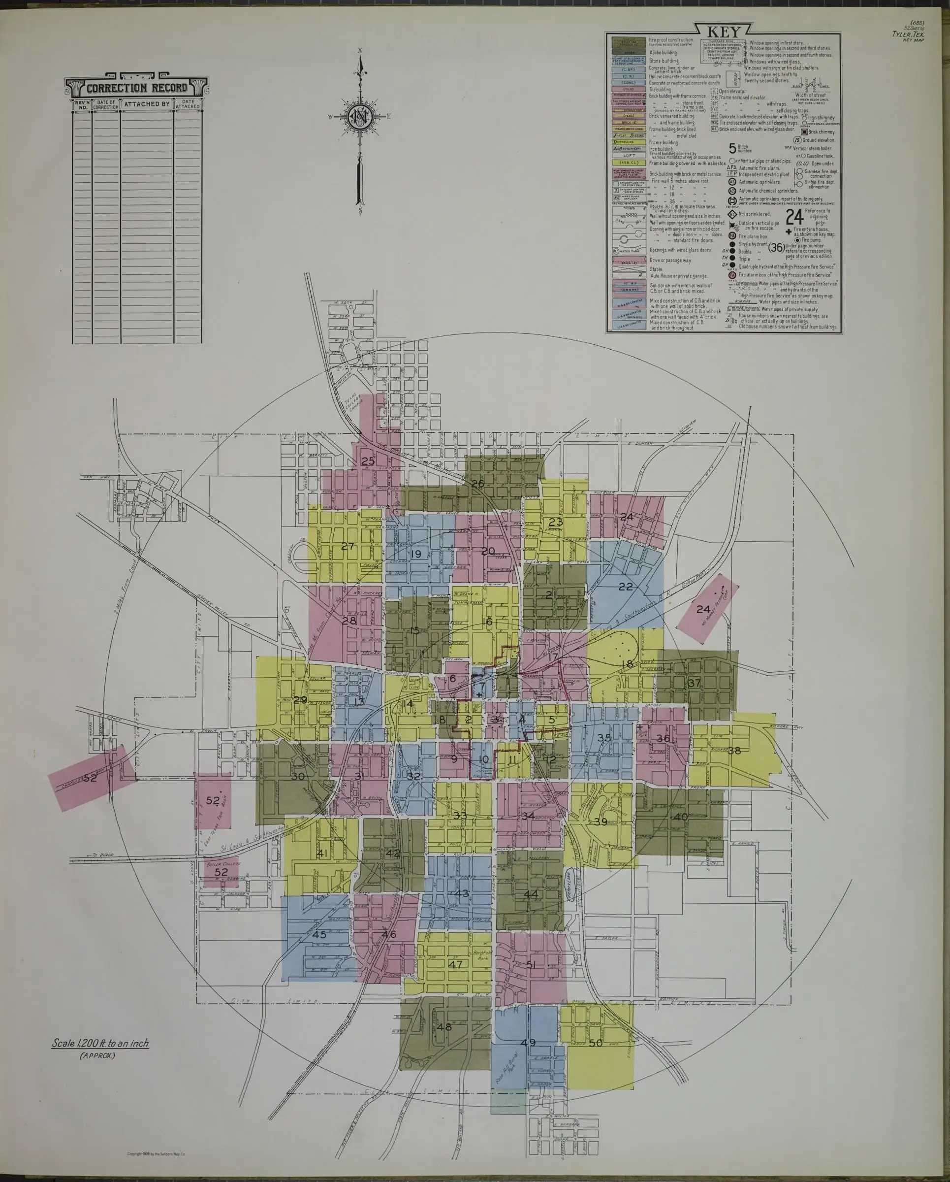
- The key map, 1938: the whole city in 52 numbered sheets. The key map (image 3 of 59), trimmed of the scanner’s edge. On BR-3 In the maps’ own words.
- The report page, as printed. Detail of the report page (image 2 of 59). On BR-3 In the maps’ own words.
- Original
- loc.gov (opens in a new tab)
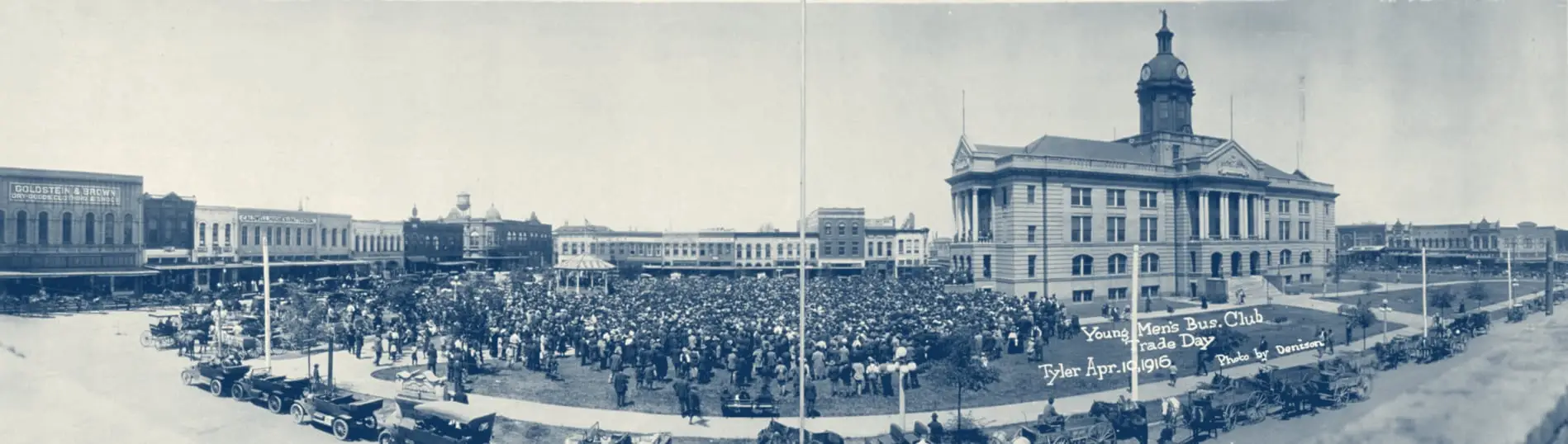
A photograph, 1916
Library of Congress, Prints and Photographs Division
Young Men's Bus. Club Trade Day, Tyler, Apr. 10, 1916 (opens in a new tab)
- Date
- April 10, 1916
- Made by
- Denison, Robert A., photographer
- Held by
- Library of Congress, Prints and Photographs Division (Panoramic Photographs, PAN SUBJECT - Events no. 52)
- Rights
- Public domain in the United States: published before 1931
- Credit line
- Robert A. Denison, photographer, "Young Men's Bus. Club Trade Day, Tyler, Apr. 10, 1916." Library of Congress, Prints and Photographs Division, Panoramic Photographs (pan 6a27240).
- Rights statement, word for word
Rights advisory: No known restrictions on publication. | Rights: The Library of Congress does not own rights to material in its collections. Therefore, it does not license or charge permission fees for use of such material and cannot grant or deny permission to publish or otherwise distribute the material. Ultimately, it is the researcher's obligation to assess copyright or other use restrictions and obtain permission from third parties when necessary before publishing or otherwise distributing materials found in the Library's collections. (Item notes: "J215128 U.S. Copyright Office"; "Copyright deposit; Robert A. Denison; April 21, 1916.")
- Shown here
- Trade Day on the courthouse square, April 10, 1916. Shown in blue ink and without its mount; the original is a sepia print. On BR-4 Timeline.
- Original
- loc.gov (opens in a new tab)
Photographs, 2014 to 2018
Under Creative Commons licenses, from Flickr and Wikimedia Commons
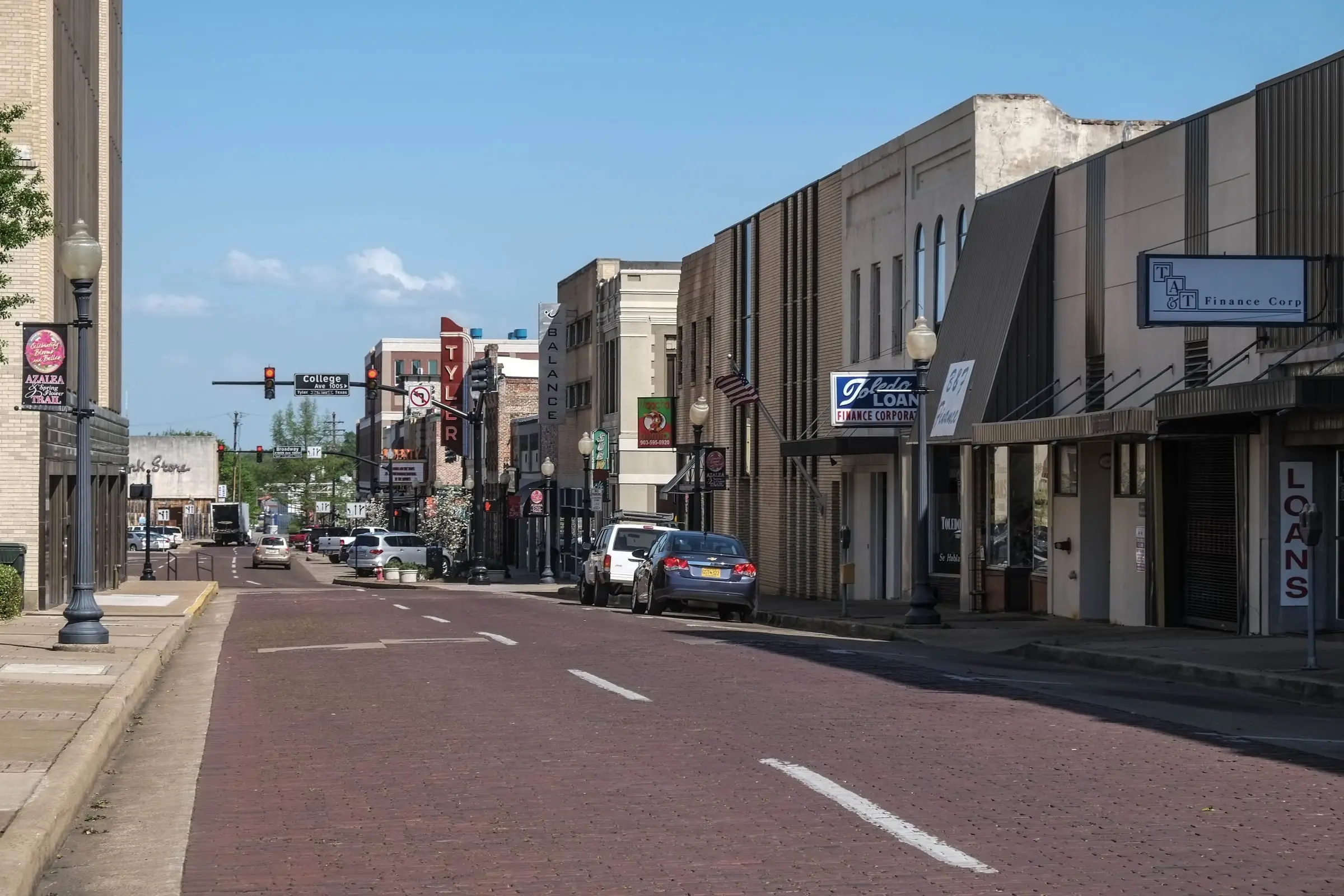
Downtown avenue with brick paving (2016) (opens in a new tab)
- Date
- March 31, 2016
- Made by
- Paul Sableman
- Held by
- Paul Sableman
- Rights
- Creative Commons Attribution 2.0
- Credit line
- Paul Sableman, CC BY 2.0 (https://creativecommons.org/licenses/by/2.0/), via Flickr
- Rights statement, word for word
Flickr license field: "CC BY 2.0" (https://creativecommons.org/licenses/by/2.0/)
- Shown here
- Tyler, 2016. Resized only; not cropped or retouched. On BR-1 Tyler's brick streets.
- Original
- flickr.com (opens in a new tab)
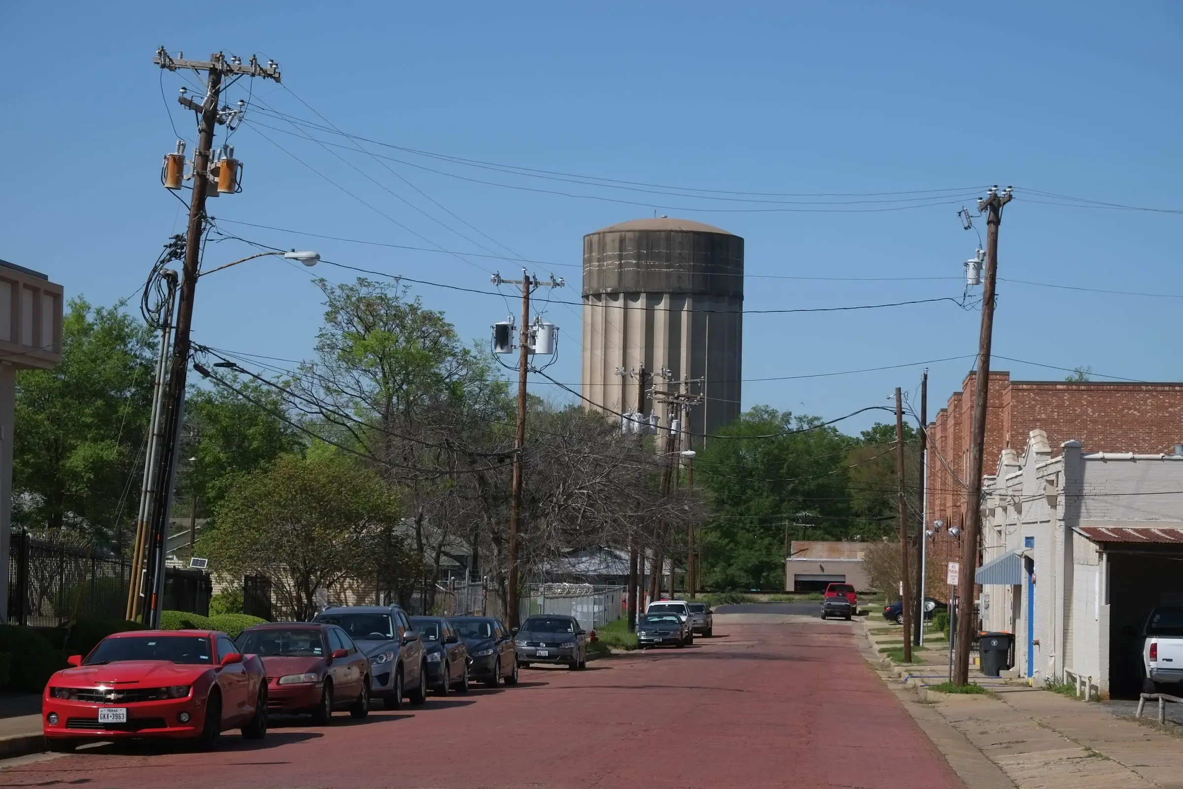
Brick-paved street with a water tower beyond (2016) (opens in a new tab)
- Date
- March 31, 2016
- Made by
- Paul Sableman
- Held by
- Paul Sableman
- Rights
- Creative Commons Attribution 2.0
- Credit line
- Paul Sableman, CC BY 2.0 (https://creativecommons.org/licenses/by/2.0/), via Flickr
- Rights statement, word for word
Flickr license field: "CC BY 2.0" (https://creativecommons.org/licenses/by/2.0/)
- Shown here
- Tyler, 2016. Resized only; not cropped or retouched. On BR-1 Tyler's brick streets.
- Original
- flickr.com (opens in a new tab)
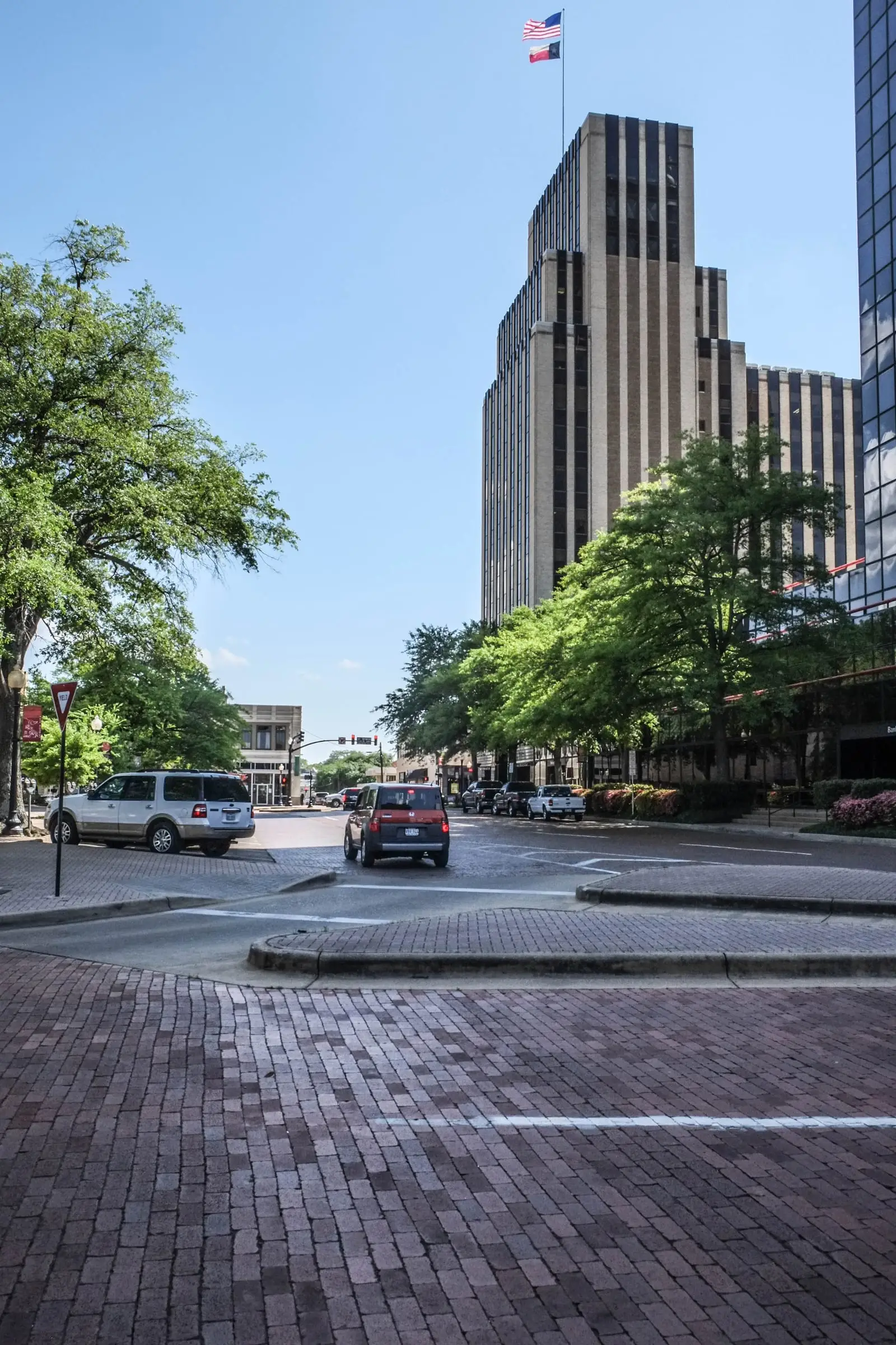
Brick street below the People's National Bank tower (2016) (opens in a new tab)
- Date
- March 31, 2016
- Made by
- Paul Sableman
- Held by
- Paul Sableman
- Rights
- Creative Commons Attribution 2.0
- Credit line
- Paul Sableman, CC BY 2.0 (https://creativecommons.org/licenses/by/2.0/), via Flickr
- Rights statement, word for word
Flickr license field: "CC BY 2.0" (https://creativecommons.org/licenses/by/2.0/)
- Shown here
- Tyler, 2016. Resized only; not cropped or retouched. On BR-1 Tyler's brick streets.
- Original
- flickr.com (opens in a new tab)
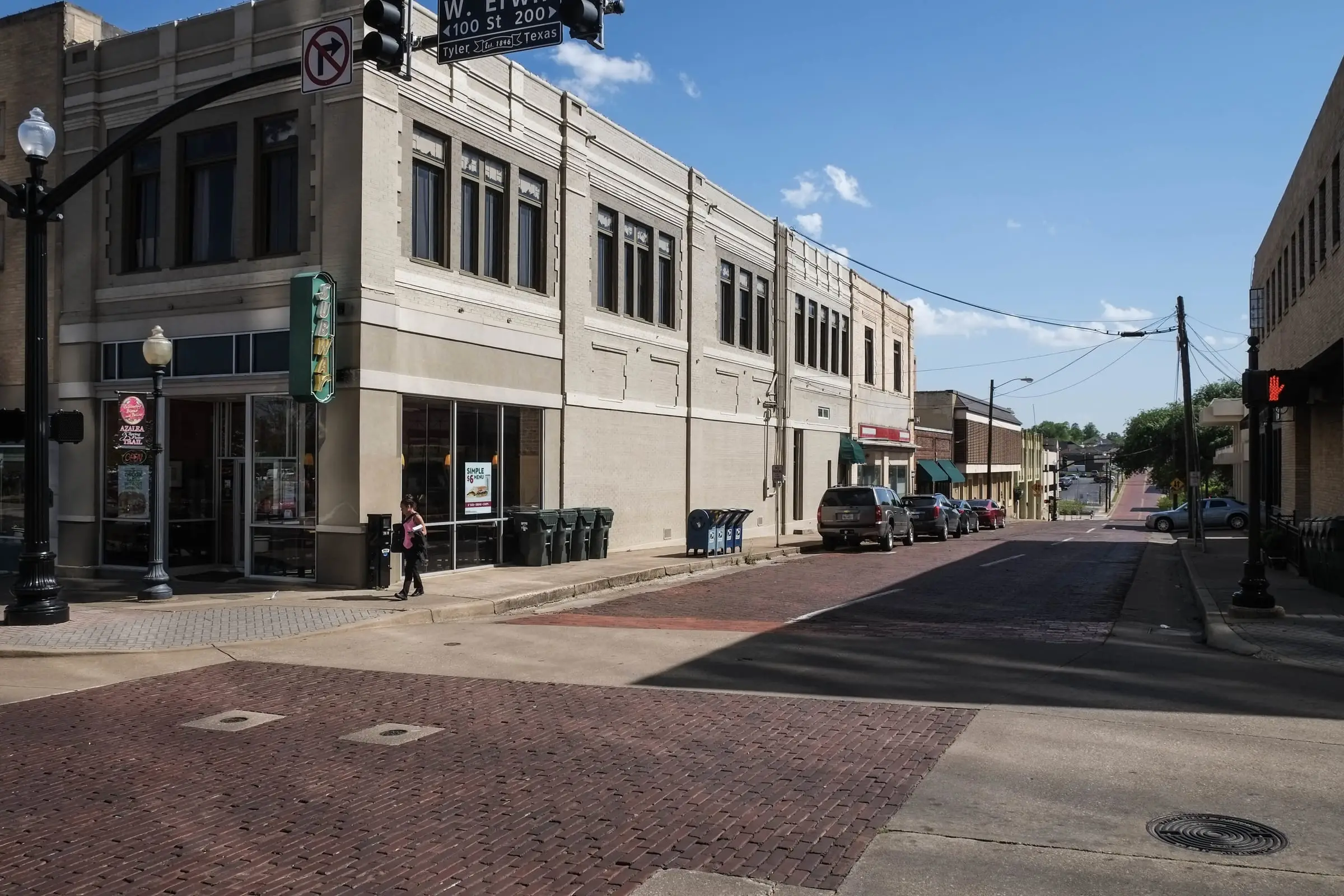
Downtown corner with brick paving and two-story commercial building (2016) (opens in a new tab)
- Date
- March 31, 2016
- Made by
- Paul Sableman
- Held by
- Paul Sableman
- Rights
- Creative Commons Attribution 2.0
- Credit line
- Paul Sableman, CC BY 2.0 (https://creativecommons.org/licenses/by/2.0/), via Flickr
- Rights statement, word for word
Flickr license field: "CC BY 2.0" (https://creativecommons.org/licenses/by/2.0/)
- Shown here
- Tyler, 2016. Resized only; not cropped or retouched. On BR-1 Tyler's brick streets.
- Original
- flickr.com (opens in a new tab)
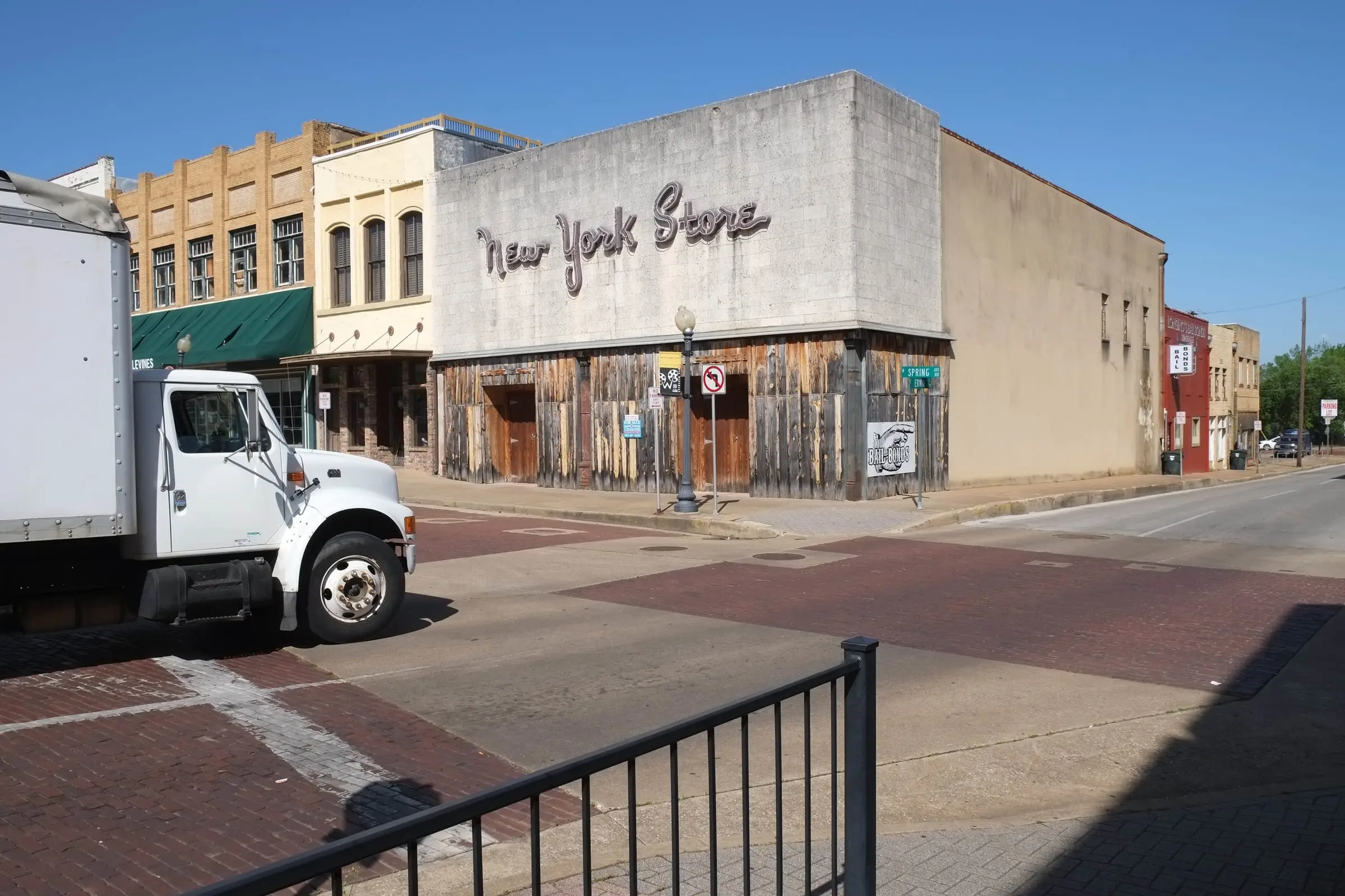
Downtown corner with the "New York Store" facade and brick paving (2016) (opens in a new tab)
- Date
- March 31, 2016
- Made by
- Paul Sableman
- Held by
- Paul Sableman
- Rights
- Creative Commons Attribution 2.0
- Credit line
- Paul Sableman, CC BY 2.0 (https://creativecommons.org/licenses/by/2.0/), via Flickr
- Rights statement, word for word
Flickr license field: "CC BY 2.0" (https://creativecommons.org/licenses/by/2.0/)
- Shown here
- Tyler, 2016. Resized only; not cropped or retouched. On BR-1 Tyler's brick streets.
- Original
- flickr.com (opens in a new tab)
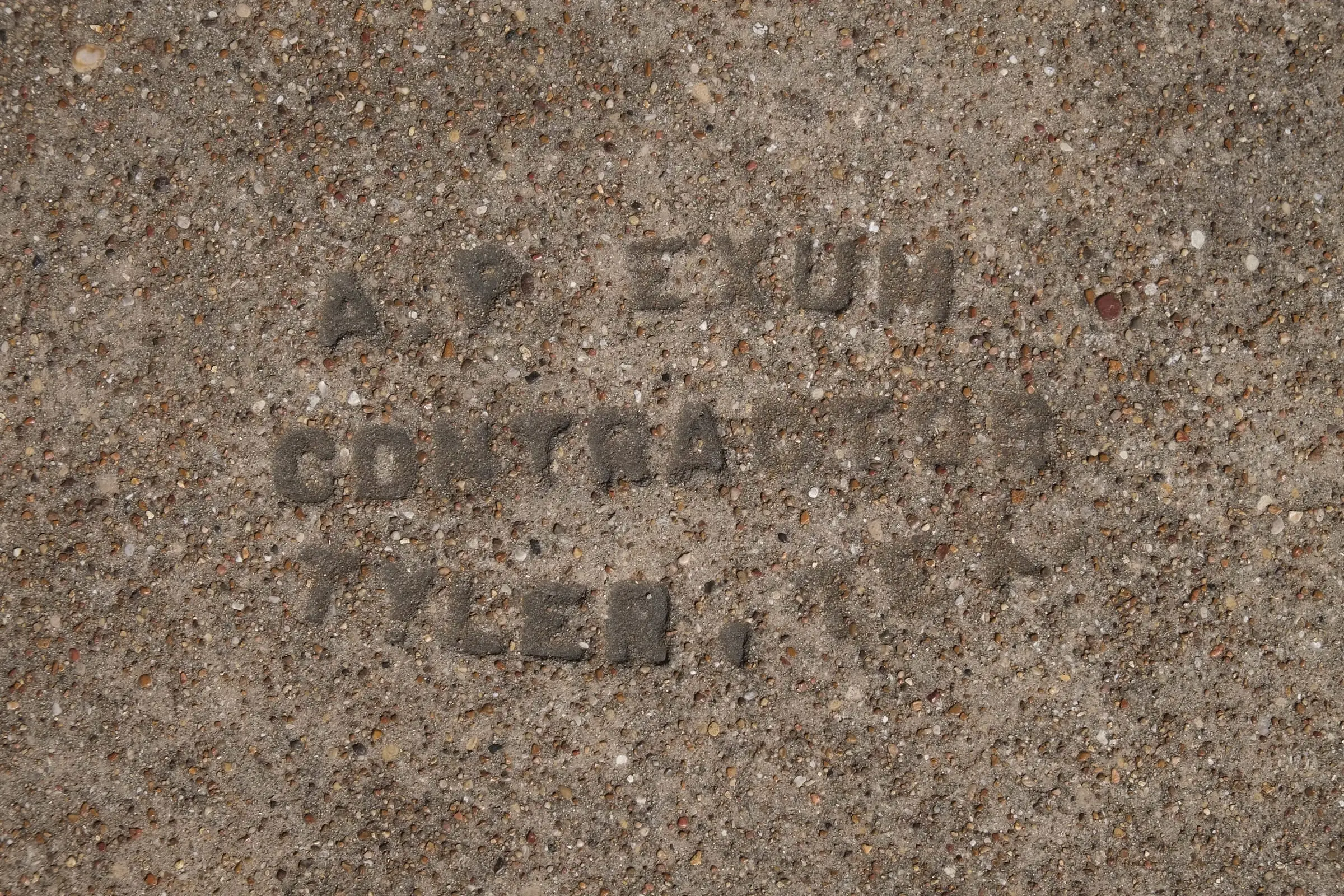
Sidewalk stamp reading "A. P. Exum Contractor Tyler, Tex." (2016) (opens in a new tab)
- Date
- March 31, 2016
- Made by
- Paul Sableman
- Held by
- Paul Sableman
- Rights
- Creative Commons Attribution 2.0
- Credit line
- Paul Sableman, CC BY 2.0 (https://creativecommons.org/licenses/by/2.0/), via Flickr
- Rights statement, word for word
Flickr license field: "CC BY 2.0" (https://creativecommons.org/licenses/by/2.0/)
- Shown here
- Tyler, 2016: a contractor’s stamp in a concrete sidewalk. It is not a brick maker’s mark. Resized only; not cropped or retouched. On BR-1 Tyler's brick streets.
- Original
- flickr.com (opens in a new tab)
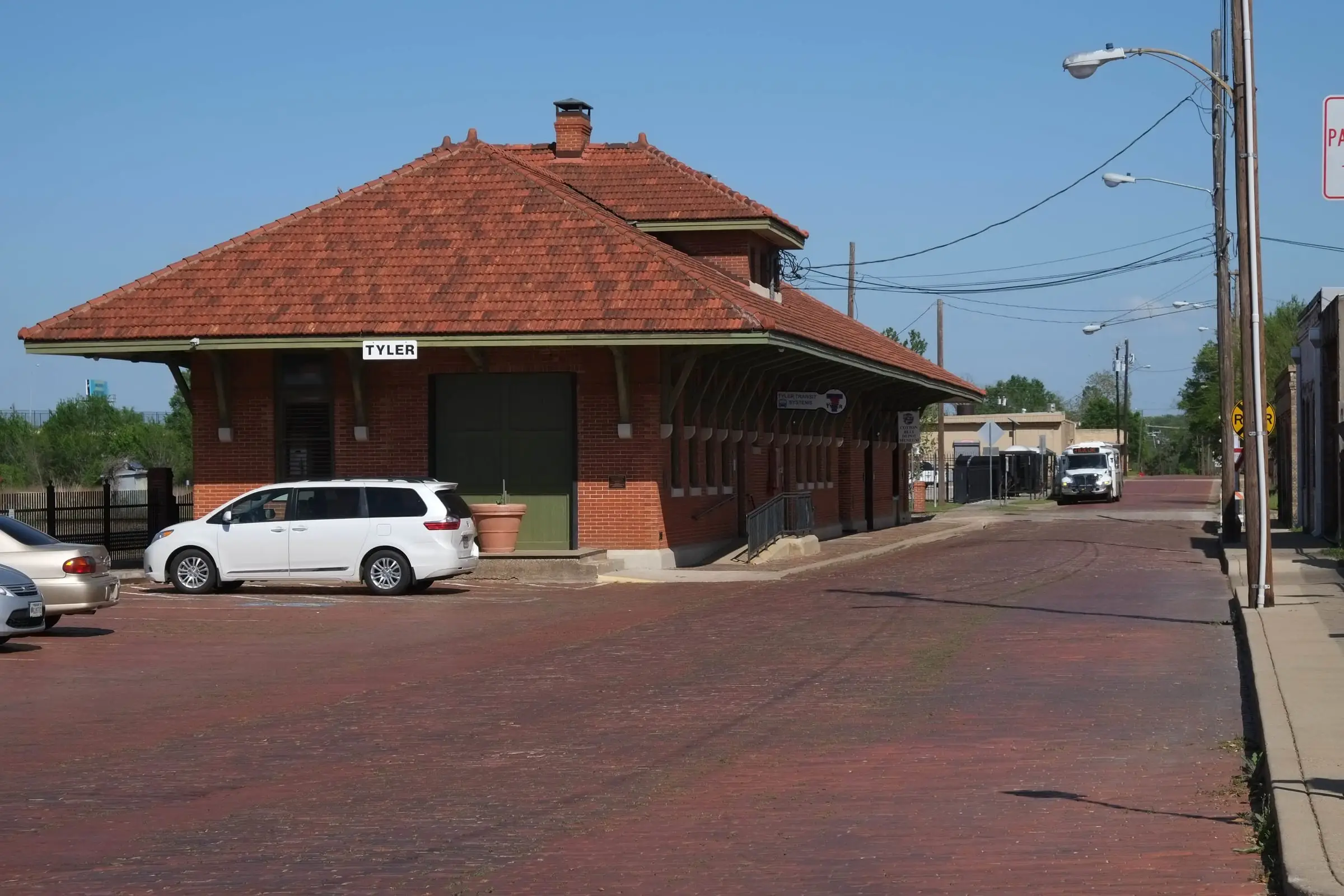
The Cotton Belt depot with a brick-paved street in front (2016) (opens in a new tab)
- Date
- March 31, 2016
- Made by
- Paul Sableman
- Held by
- Paul Sableman
- Rights
- Creative Commons Attribution 2.0
- Credit line
- Paul Sableman, CC BY 2.0 (https://creativecommons.org/licenses/by/2.0/), via Flickr
- Rights statement, word for word
Flickr license field: "CC BY 2.0" (https://creativecommons.org/licenses/by/2.0/)
- Shown here
- The Cotton Belt depot, Tyler, 2016. Resized only; not cropped or retouched. On BR-4 Timeline.
- Original
- flickr.com (opens in a new tab)
Erwin Street in Tyler , Texas ( United States ). (opens in a new tab)
- Date
- Taken on 28 May 2016
- Made by
- Michael Barera
- Held by
- Michael Barera
- Rights
- Creative Commons Attribution-ShareAlike 4.0
- Credit line
- Michael Barera / Wikimedia Commons, CC BY-SA 4.0 (https://creativecommons.org/licenses/by-sa/4.0/)
- Rights statement, word for word
I, the copyright holder of this work, hereby publish it under the following license: This file is licensed under the Creative Commons Attribution-Share Alike 4.0 International license. This file is licensed under the Creative Commons Attribution-Share Alike 3.0 Unported license. (Also available under the GNU Free Documentation License.)
- Shown here
- Erwin Street, May 28, 2016. Resized only; not cropped or retouched. On BR-7 The lift.
Ferguson Street in Tyler , Texas ( United States ). (opens in a new tab)
- Date
- Taken on 28 May 2016
- Made by
- Michael Barera
- Held by
- Michael Barera
- Rights
- Creative Commons Attribution-ShareAlike 4.0
- Credit line
- Michael Barera / Wikimedia Commons, CC BY-SA 4.0 (https://creativecommons.org/licenses/by-sa/4.0/)
- Rights statement, word for word
I, the copyright holder of this work, hereby publish it under the following license: This file is licensed under the Creative Commons Attribution-Share Alike 4.0 International license. This file is licensed under the Creative Commons Attribution-Share Alike 3.0 Unported license. (Also available under the GNU Free Documentation License.)
- Shown here
- Ferguson Street, May 28, 2016. Resized only; not cropped or retouched. On BR-7 The lift.
Brick Streets Neighborhood Historic District, Tyler (2018) (opens in a new tab)
- Date
- 2 July 2018, 12:50:42
- Made by
- Renelibrary
- Held by
- Renelibrary
- Rights
- Creative Commons Attribution-ShareAlike 4.0
- Credit line
- Renelibrary (image watermarked © Rene Gomez) / Wikimedia Commons, CC BY-SA 4.0 (https://creativecommons.org/licenses/by-sa/4.0/)
- Rights statement, word for word
I, the copyright holder of this work, hereby publish it under the following license: This file is licensed under the Creative Commons Attribution-Share Alike 4.0 International license.
- Shown here
- In the Brick Streets Neighborhood Historic District, July 2018. Resized only; not cropped or retouched. On BR-4 Timeline.
Charnwood Residential Historic District, Tyler (2018) (opens in a new tab)
- Date
- 2 July 2018, 12:57:39
- Made by
- Renelibrary
- Held by
- Renelibrary
- Rights
- Creative Commons Attribution-ShareAlike 4.0
- Credit line
- Renelibrary (image watermarked © Rene Gomez) / Wikimedia Commons, CC BY-SA 4.0 (https://creativecommons.org/licenses/by-sa/4.0/)
- Rights statement, word for word
I, the copyright holder of this work, hereby publish it under the following license: This file is licensed under the Creative Commons Attribution-Share Alike 4.0 International license.
- Shown here
- In the Charnwood Residential Historic District, July 2018. Resized only; not cropped or retouched. On BR-4 Timeline.
East Ferguson Residential Historic District, Tyler (2014) (opens in a new tab)
- Date
- 28 November 2014, 12:39:45
- Made by
- Renelibrary
- Held by
- Renelibrary
- Rights
- Creative Commons Attribution-ShareAlike 4.0
- Credit line
- Renelibrary / Wikimedia Commons, CC BY-SA 4.0 (https://creativecommons.org/licenses/by-sa/4.0/)
- Rights statement, word for word
I, the copyright holder of this work, hereby publish it under the following license: This file is licensed under the Creative Commons Attribution-Share Alike 4.0 International license.
- Shown here
- In the East Ferguson Residential Historic District, November 2014. Resized only; not cropped or retouched. On BR-4 Timeline.


Everything else
Everything not listed above is drawn for this site: the dots, the plates, the lift, the charts and the street you lay. The base map is OpenFreeMap vector tiles, drawn with MapLibre; map data is © OpenStreetMap contributors, under the ODbL.
Type: Stardos Stencil and Atkinson Hyperlegible Next, both under the SIL Open Font License. Icons: Phosphor.
The words on every sheet rest on sources listed on Sources and methods.